The Smart City reinvented by computer vision

Discover how computer vision and AI are redefining smart cities, for smoother, safer and more sustainable infrastructure.

Technology at the service of smart cities

Computer vision combined with artificial intelligence is revolutionizing the Smart City. It optimizes infrastructure management, improves the fluidity of travel and strengthens urban security.

Analyse des flux de déplacements

Analysis of travel flows

Cameras can track the movements of pedestrians, vehicles and cyclists. This data can be used to optimize intersection management and efficiently plan urban infrastructure.

Optimisation des infrastructures routières

Optimization of road infrastructure

AI identifies congestion areas and adjusts traffic light management in real time. This helps reduce traffic jams and improve traffic flow.

Amélioration de la sécurité

Improved security

Computer vision detects risky behavior, such as speeding or reckless crossing, and alerts in real time to prevent accidents.

Personnalisation de l’expérience client

Personalization of the customer experience

By analyzing public transportation flows and eco-friendly travel modes, AI encourages more environmentally friendly choices. This reduces the carbon footprint and improves the quality of urban life.

Cutting-edge technologies for urban mobility

Advanced technologies and powerful algorithms are transforming urban mobility management, optimizing travel and sustainability

Algorithmes de détection et de suivi

Detection and tracking algorithms

Models like YOLO and Faster R-CNN help identify and localize vehicles, pedestrians and cyclists. To track their trajectories, solutions like DeepSORT and ByteTrack ensure continuous and accurate monitoring

Vision multispectrale

Multispectral vision

Thanks to infrared cameras and LIDAR systems, multispectral vision offers unparalleled perception, whether for nighttime tracking or for accurately measuring distances and volumes in complex environments.

Réseaux neuronaux avancés

Advanced Neural Networks

CNNs are used to recognize objects and scenes, while RNNs analyze mobility flows across time series, improving prediction of trends and behaviors

Edge computing et fusion multimodale

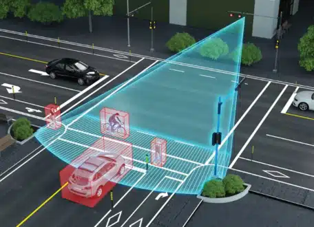
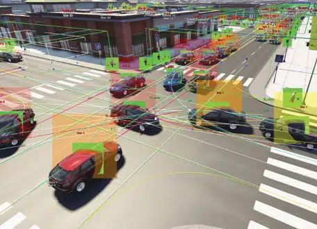
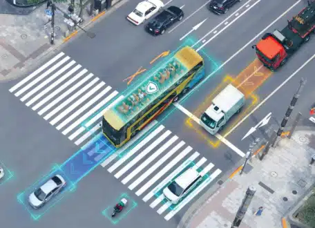
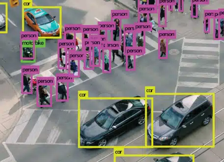
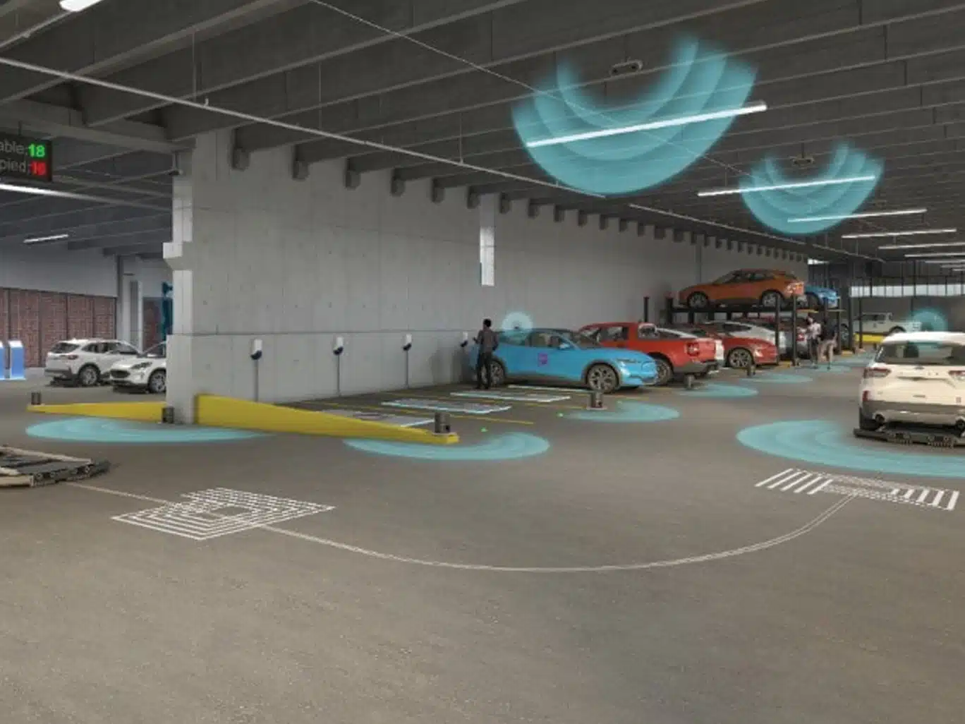
Edge computing and multimodal fusion

Smart cameras process data locally, reducing latency and bandwidth consumption. Multimodal fusion integrates this information with sensor data, such as traffic sensors and GPS, for a holistic and coherent view of urban flows.

Challenges and limitations

Challenges to overcome in exploiting the potential of computer vision in the Smart City

Précision et complexité

Precision and complexity

Changes in lighting, bad weather or obstacles reduce the reliability of analyses. To improve performance, models need to be trained on diverse and representative data.

Vie privée et régulations

Privacy and regulations

Massive video data collection raises privacy concerns. Anonymizing streams and complying with regulations like GDPR are essential to ensure citizen trust

Coût et infrastructure

Cost and infrastructure

Implementing high-resolution cameras and real-time processing systems requires significant investments. Integration with existing urban infrastructure also remains a challenge.

Inspiring use cases in the Smart City

These real-world applications illustrate the enormous potential of this technology to make business processes more efficient, secure and personalized.

Singapour

Singapore

With smart cameras and vision algorithms, Singapore analyzes traffic in real time, reducing congestion and optimizing the punctuality of public transport

Barcelone

Barcelona

Barcelona uses computer vision to analyze pedestrian flows and identify risky behaviors. This approach increases safety and improves the organization of urban spaces

Los Angeles

Los Angeles

Vision systems detect vacant spaces and direct drivers, reducing search time and parking-related emissions